

Better Lost Than Duffers: Walking Offa's Dyke Path and the Cumbria Way
 Jun 6th, 2023, 03:10 PM
#1
Original Poster
Join Date: Jul 2004
Posts: 4,470
Likes: 0
Received 0 Likes
on
0 Posts
Better Lost Than Duffers: Walking Offa's Dyke Path and the Cumbria Way
This trip report may not have broad appeal, given its focus on long-distance walking, but it may inspire others to visit Wales or the Lake District. Both are very beautiful, as you will see in the photos.
We made this trip last month, flying from Halifax, Nova Scotia to Glasgow, where we spent a couple of days. We then went by rail to Hereford and onward by taxi to Hay-on-Wye in Wales for two days of walking on part of Offa�s Dyke Path. This was followed by a rail transfer to Ulverston, in Cumbria, from where we walked the Cumbria Way to Carlisle. We returned to Glasgow and flew home.
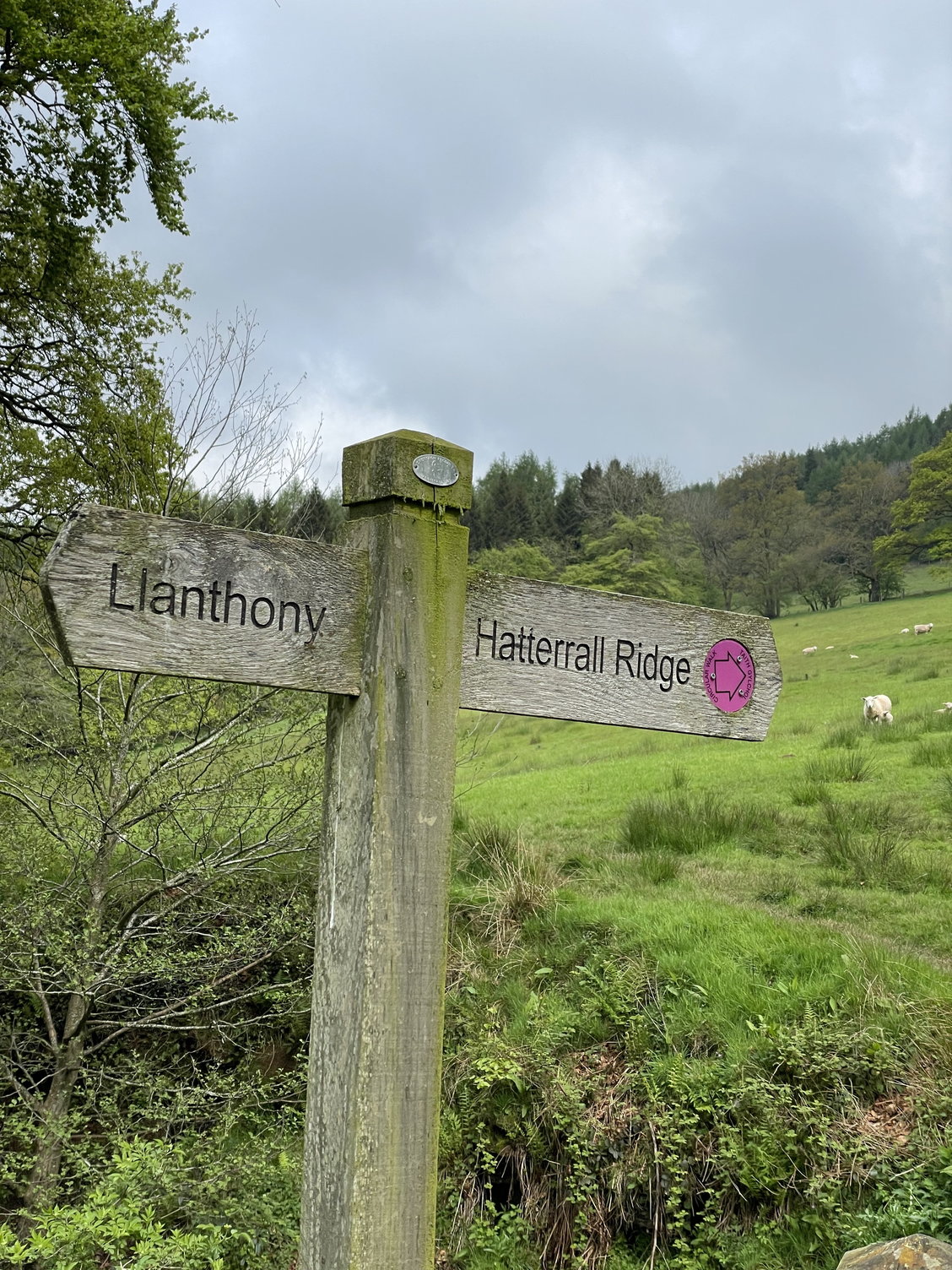
Llanthony Priory to Hay-on-Wye
Our first steps were straight up an escarpment, from the ruins of Llanthony Priory in the Vale of Ewyas up onto Hatterrall Ridge. We had been delivered to the priory by taxi from our inn in Hay-on-Wye; our driver pointed to the start of the trail and said, �I hope you have a good day, but I will say that I am happy that it is you who are doing it, and not me.�
Looking back at the ruins of the priory:

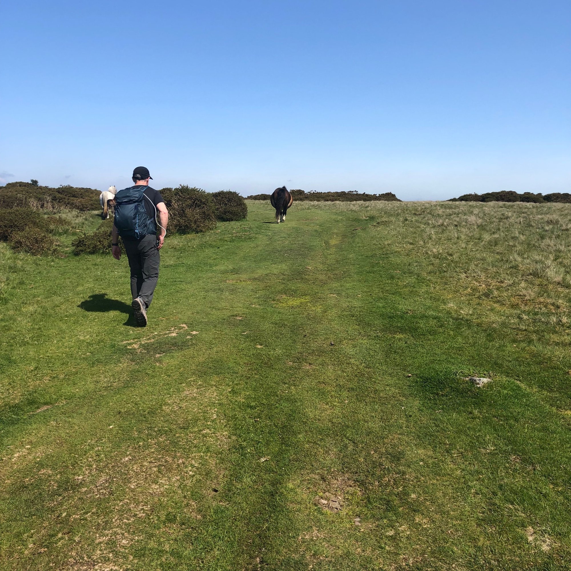
The climb was very stiff, rising 300 metres, and somewhere in the middle of that we each concluded that this was a terrible way to start eight days of hiking. But eventually we were on the ridge, where we were immediately welcomed by wild Welsh ponies. We were now on Offa�s Dyke Path, running north back to Hay-on-Wye, about 19 kilometres away. (The footpath itself is 285 km in length, running from the Severn Estuary to Prestatyn on the Irish Sea.)

Hatterrall Ridge is high, barren, and devoid of any shelter whatsoever, but we were fortunate with a mixture of cloud and sun. The wind, which can howl in that exposure, was brisk but tolerable. Running on our left was the deep Vale of Ewyas in Wales; on our right the equally-deep Olchon Valley in England. The path (and the spine of the ridge) followed the border between the two countries.
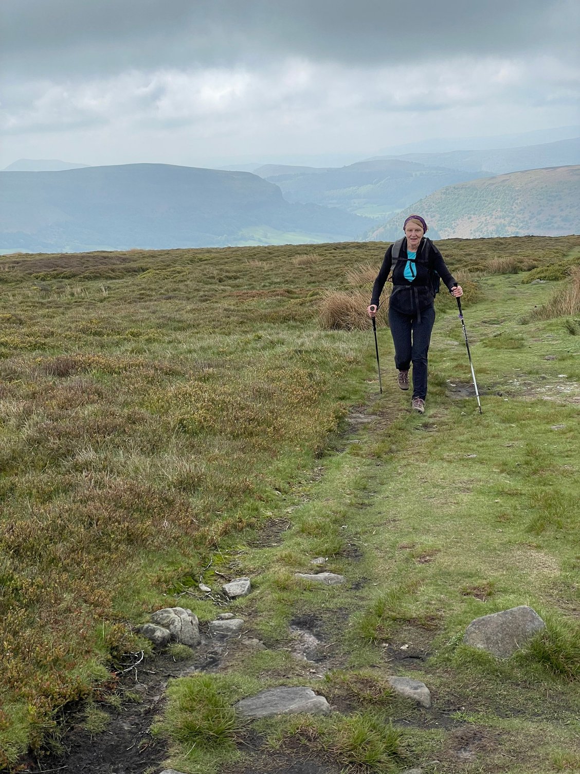
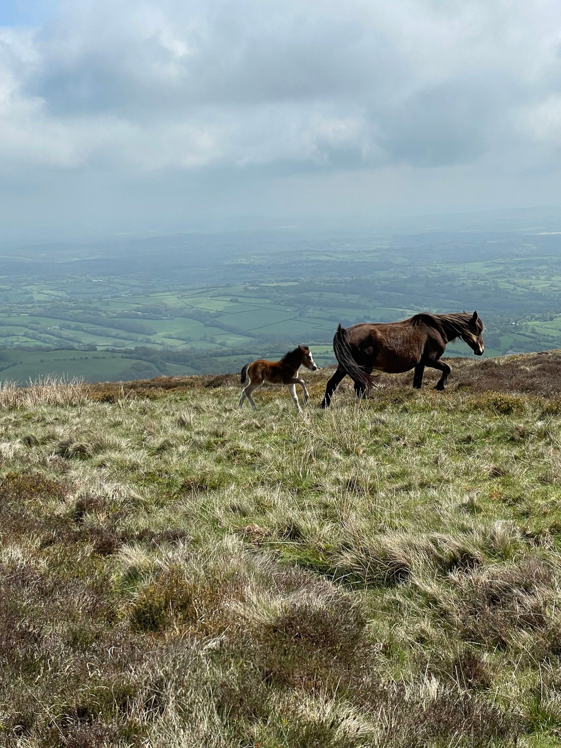
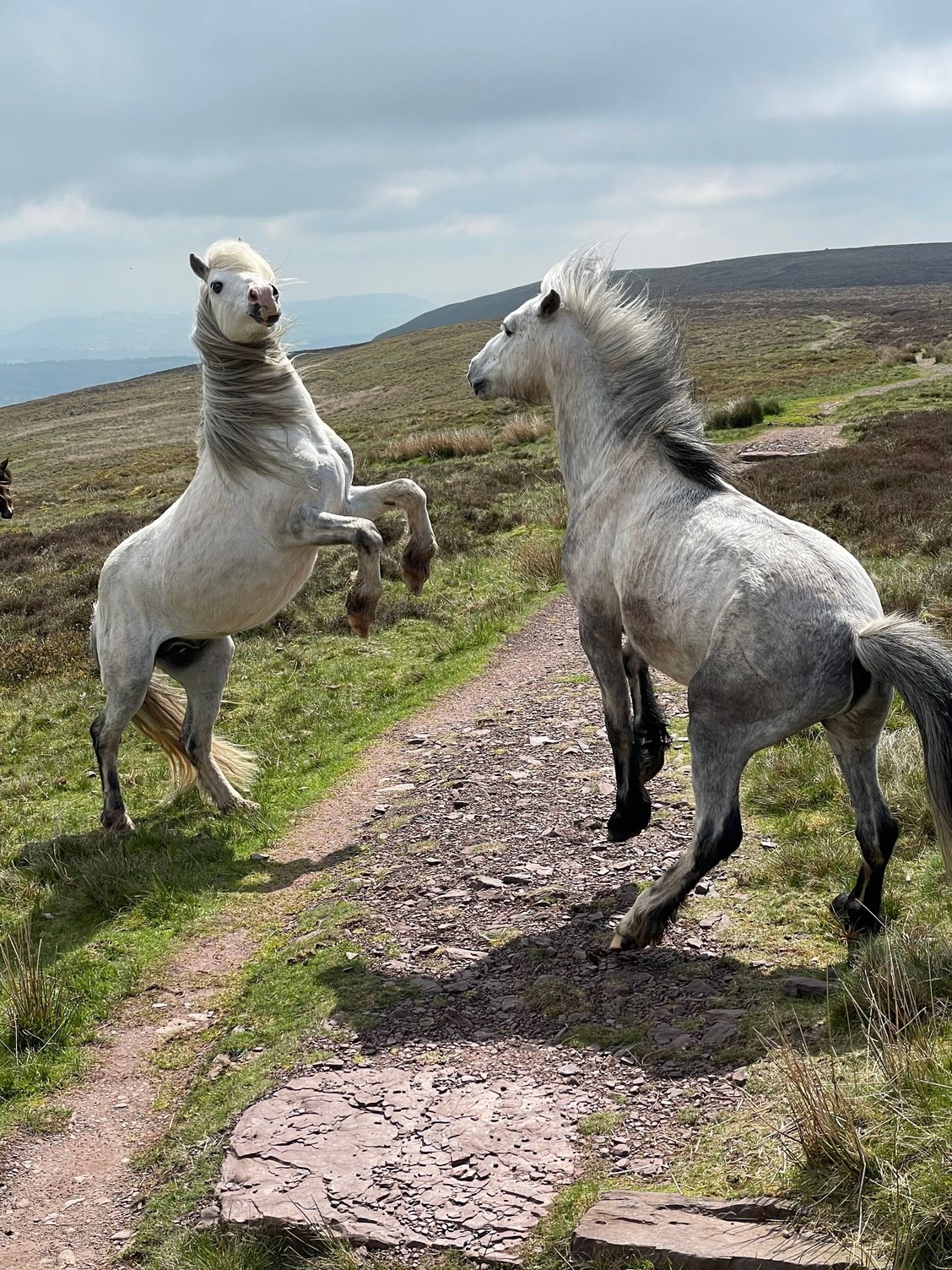
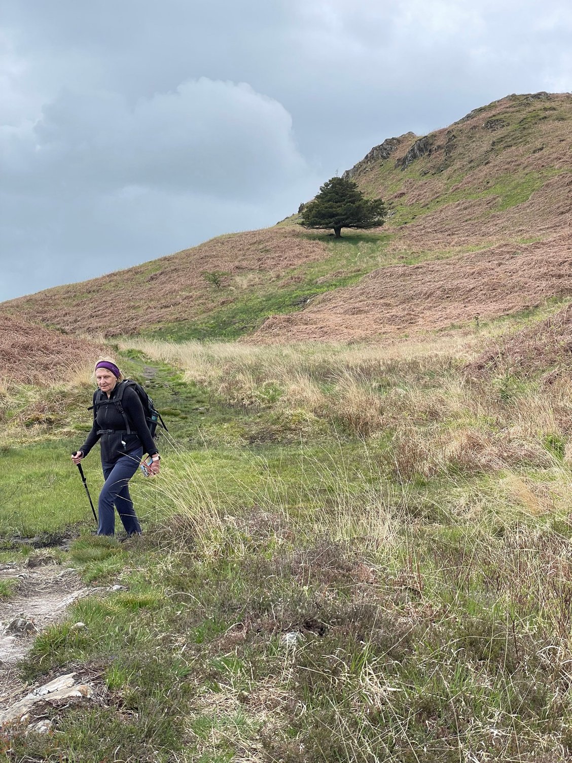
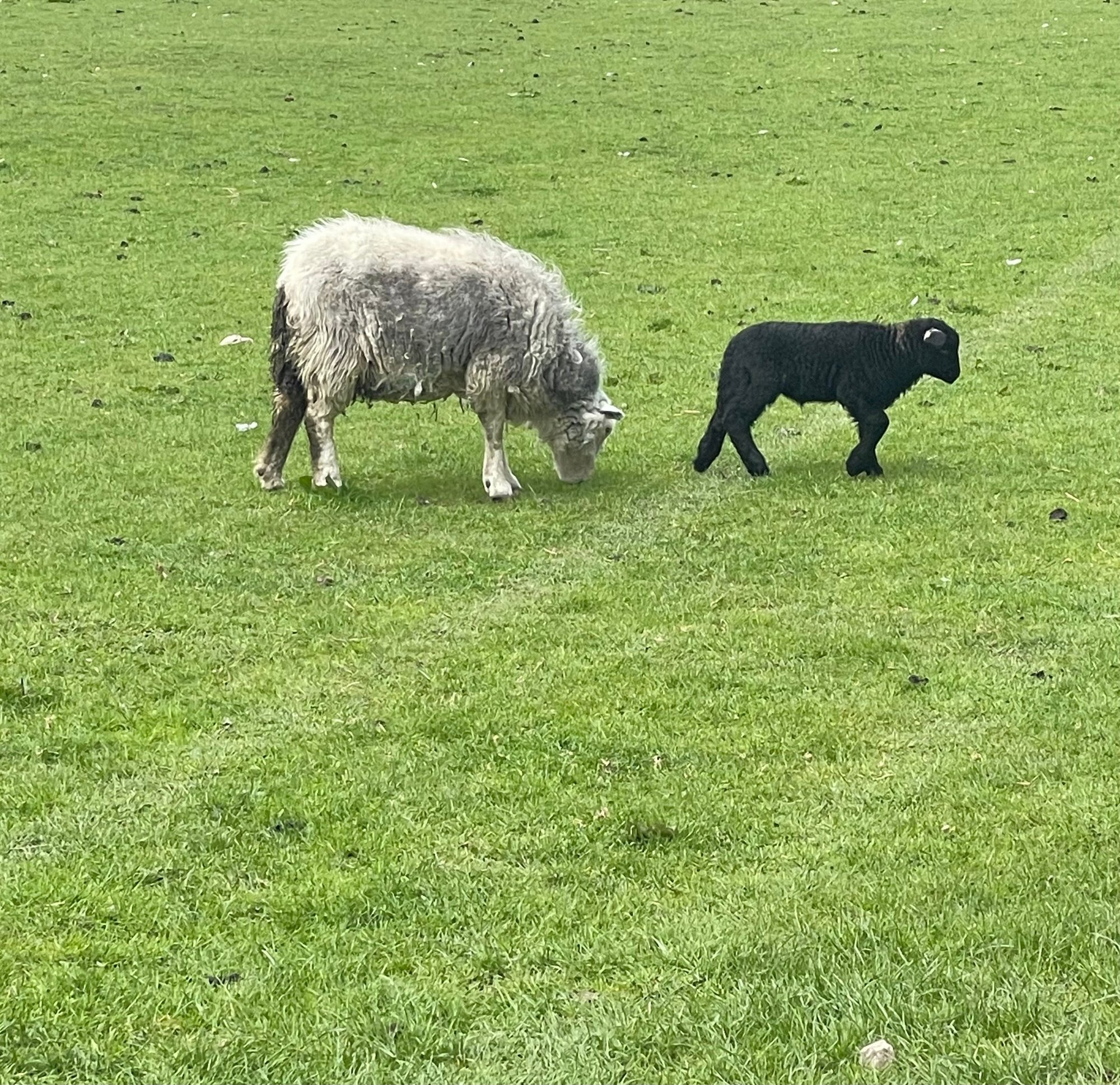
We met a few other walkers, but we were mostly on our own. Red kites soared overhead, and we continued to see groups of wild ponies, including mares with new foals. On one occasion two beautiful stallions sparred for a moment, by chance just a few metres from where we sat eating our lunch. Sheep were ubiquitous.
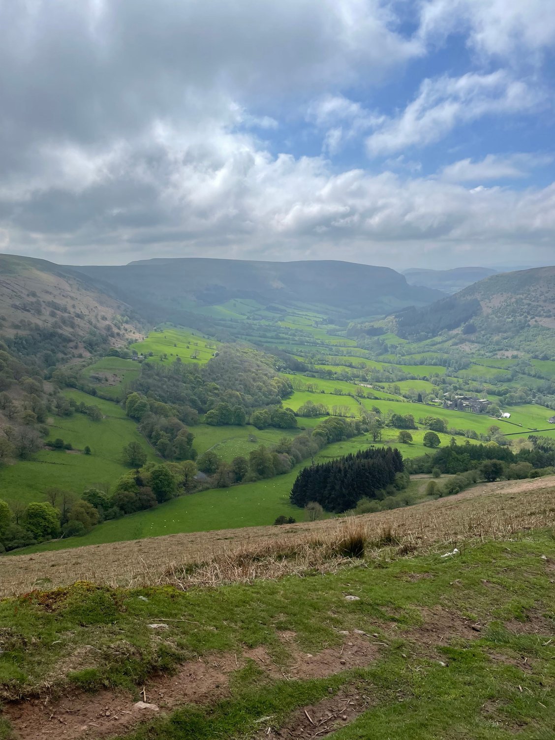
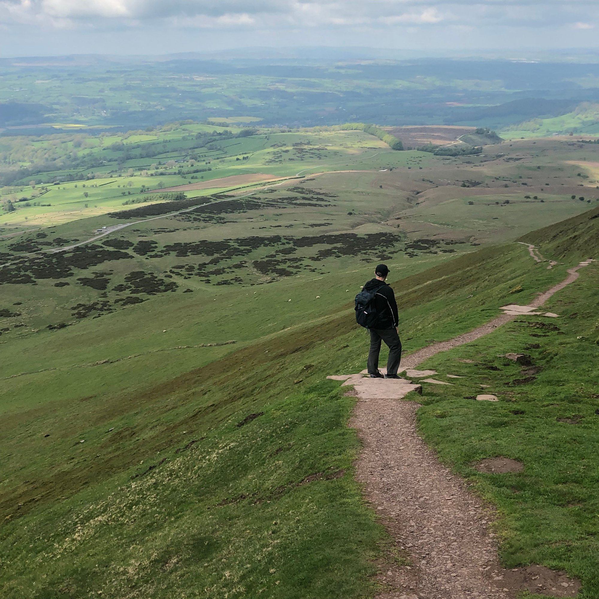
The northern end of the ridge culminates in Hay Bluff, but we missed the turn that would have taken us gently around the eastern side of that. We walked instead to the peak of the bluff, and while it afforded a magnificent view down to Hay, it meant a rugged descent on another steep hillside.
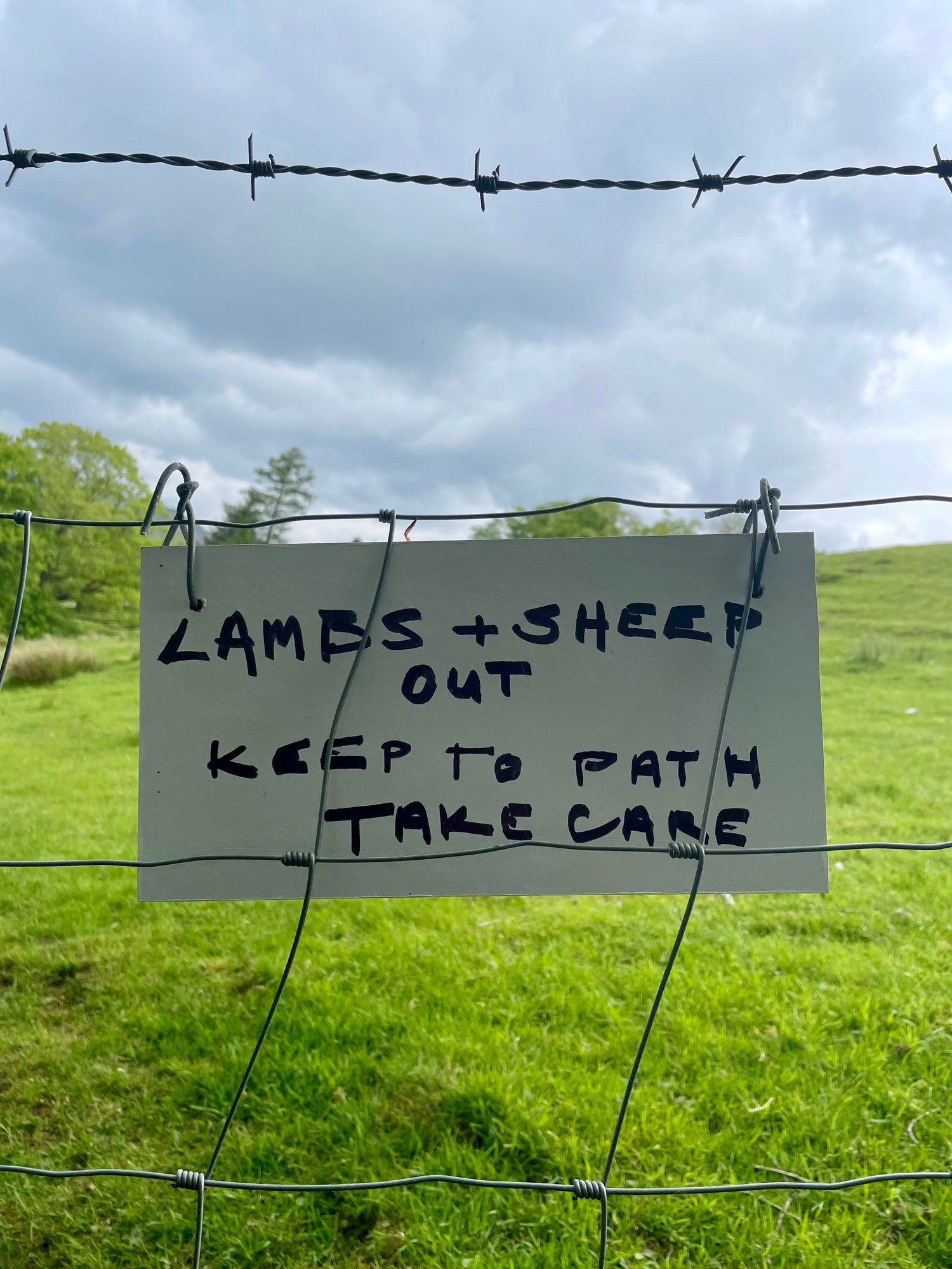
We finally rejoined the official path, and then walked fields and woods, crossed steams, and manoeuvred farmyards, frequently under the gaze of sheep and lambs.
Stats for the day: 18.5 km, total time on the trail about 6.5 hours. A good beginning.
We had arranged this part of our holiday through Celtic Trails, who booked our accommodation and transfers. They describe this package as �The Heights of Offa�s Dyke,� appropriately named, as Hatterrall Ridge on the first day and the Hergest Ridge on the second are the highest points on the entire path. I would recommend Celtic Trails without hesitation. They are responsive, helpful, and thorough in their attention to detail. Their walking pack (maps, guidebook, specific arrangements, and supplementary information on restaurants and amenities) was very good. https://www.celtictrailswalkingholid...h/#itineraries
Our accommodation for four nights in Hay-on-Wye: the Old Black Lion (�Boots & Paws Welcome,� according to the sign outside). It�s a 17th-century inn, a welcoming place where one will meet other walkers. The restaurant is very solid.
Tomorrow: our second day of walking
We made this trip last month, flying from Halifax, Nova Scotia to Glasgow, where we spent a couple of days. We then went by rail to Hereford and onward by taxi to Hay-on-Wye in Wales for two days of walking on part of Offa�s Dyke Path. This was followed by a rail transfer to Ulverston, in Cumbria, from where we walked the Cumbria Way to Carlisle. We returned to Glasgow and flew home.
Llanthony Priory to Hay-on-Wye
Our first steps were straight up an escarpment, from the ruins of Llanthony Priory in the Vale of Ewyas up onto Hatterrall Ridge. We had been delivered to the priory by taxi from our inn in Hay-on-Wye; our driver pointed to the start of the trail and said, �I hope you have a good day, but I will say that I am happy that it is you who are doing it, and not me.�
Looking back at the ruins of the priory:
The climb was very stiff, rising 300 metres, and somewhere in the middle of that we each concluded that this was a terrible way to start eight days of hiking. But eventually we were on the ridge, where we were immediately welcomed by wild Welsh ponies. We were now on Offa�s Dyke Path, running north back to Hay-on-Wye, about 19 kilometres away. (The footpath itself is 285 km in length, running from the Severn Estuary to Prestatyn on the Irish Sea.)
Hatterrall Ridge is high, barren, and devoid of any shelter whatsoever, but we were fortunate with a mixture of cloud and sun. The wind, which can howl in that exposure, was brisk but tolerable. Running on our left was the deep Vale of Ewyas in Wales; on our right the equally-deep Olchon Valley in England. The path (and the spine of the ridge) followed the border between the two countries.
We met a few other walkers, but we were mostly on our own. Red kites soared overhead, and we continued to see groups of wild ponies, including mares with new foals. On one occasion two beautiful stallions sparred for a moment, by chance just a few metres from where we sat eating our lunch. Sheep were ubiquitous.
The northern end of the ridge culminates in Hay Bluff, but we missed the turn that would have taken us gently around the eastern side of that. We walked instead to the peak of the bluff, and while it afforded a magnificent view down to Hay, it meant a rugged descent on another steep hillside.
We finally rejoined the official path, and then walked fields and woods, crossed steams, and manoeuvred farmyards, frequently under the gaze of sheep and lambs.
Stats for the day: 18.5 km, total time on the trail about 6.5 hours. A good beginning.
We had arranged this part of our holiday through Celtic Trails, who booked our accommodation and transfers. They describe this package as �The Heights of Offa�s Dyke,� appropriately named, as Hatterrall Ridge on the first day and the Hergest Ridge on the second are the highest points on the entire path. I would recommend Celtic Trails without hesitation. They are responsive, helpful, and thorough in their attention to detail. Their walking pack (maps, guidebook, specific arrangements, and supplementary information on restaurants and amenities) was very good. https://www.celtictrailswalkingholid...h/#itineraries
Our accommodation for four nights in Hay-on-Wye: the Old Black Lion (�Boots & Paws Welcome,� according to the sign outside). It�s a 17th-century inn, a welcoming place where one will meet other walkers. The restaurant is very solid.
Tomorrow: our second day of walking

 Jun 7th, 2023, 12:30 AM
#7
Original Poster
Join Date: Jul 2004
Posts: 4,470
Likes: 0
Received 0 Likes
on
0 Posts
Hay-on-Wye to Kington
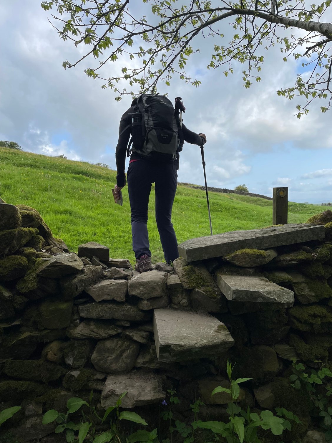
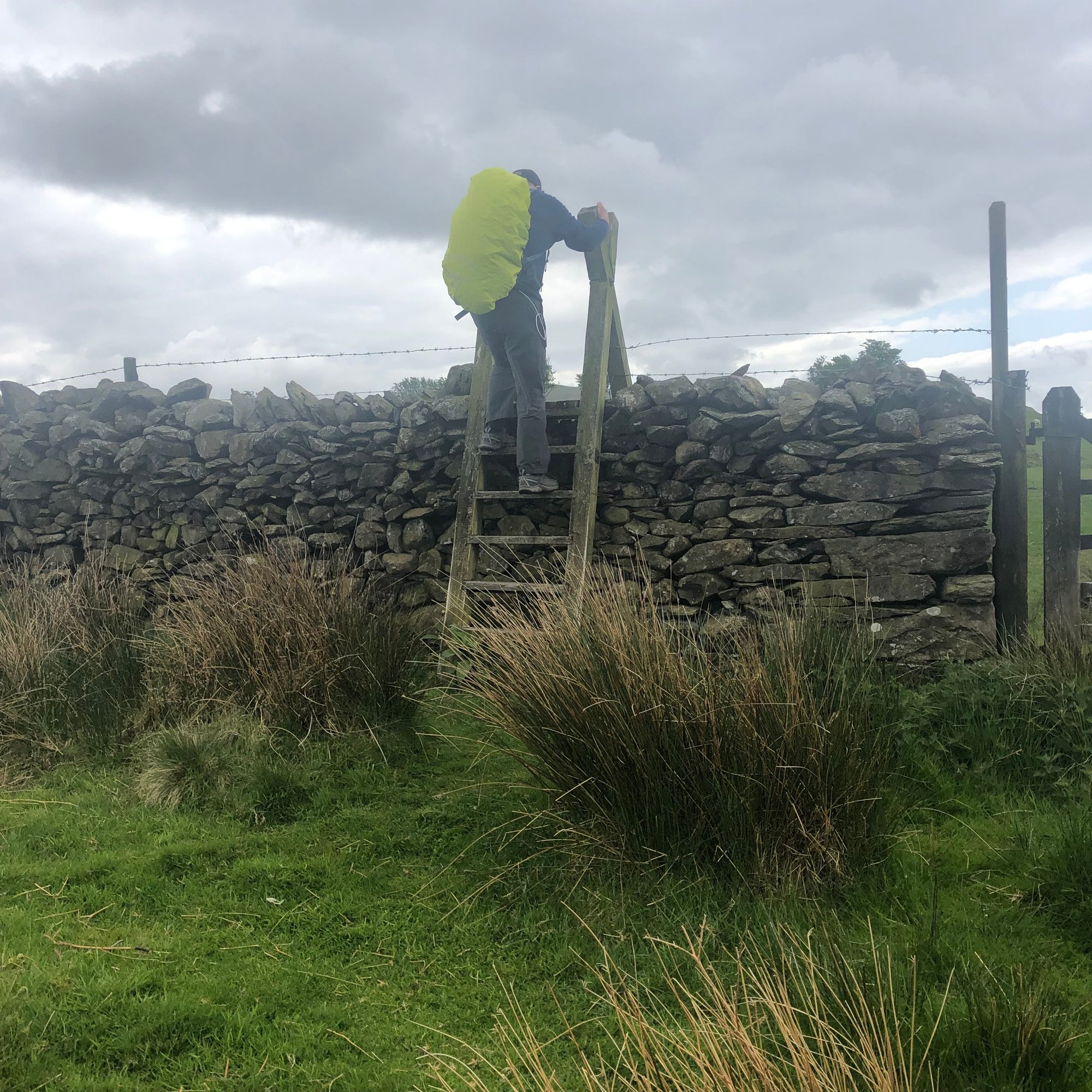
Our second day was a walk from Hay to Kington, about 24 kilometres to the north. We set off around 9 am, walking at first under cloud, but then in heat and sunshine. We were soon in short-sleeved tees and wishing we had worn our shorts. We started with a pleasant walk by the Hay River, and we were soon back among hundreds of sheep. Fences and dry-stone walls ran beside us or across in front of us; regular gates, kissing gates, and stiles led from one field to another. We occasionally followed streams, and in these places we often encountered deep, slippery mud.


Mid-morning we met a bullock. The risk of injury by cattle had been on the mind of my wife Jeane, who had spent her early childhood on a farm. �Of all the ways I could possibly die, the last thing I want is to die by cow!� I know, it sounds like a remote possibility, but it does happen. (According to this report in the BBC, those who work with cattle are at the greatest risk, but it also happens to walkers, especially if they are accompanied by a dog. We, happily, were dogless. https://www.bbc.co.uk/news/uk-englan...shire-54268160 ) This particular bullock was alone in the field, but near our next gate. He started to walk away as we approached, but then he turned, lowered his head, and made a feint towards me. Happily, he immediately lost interest, and turned away again. We scooted through the gate.
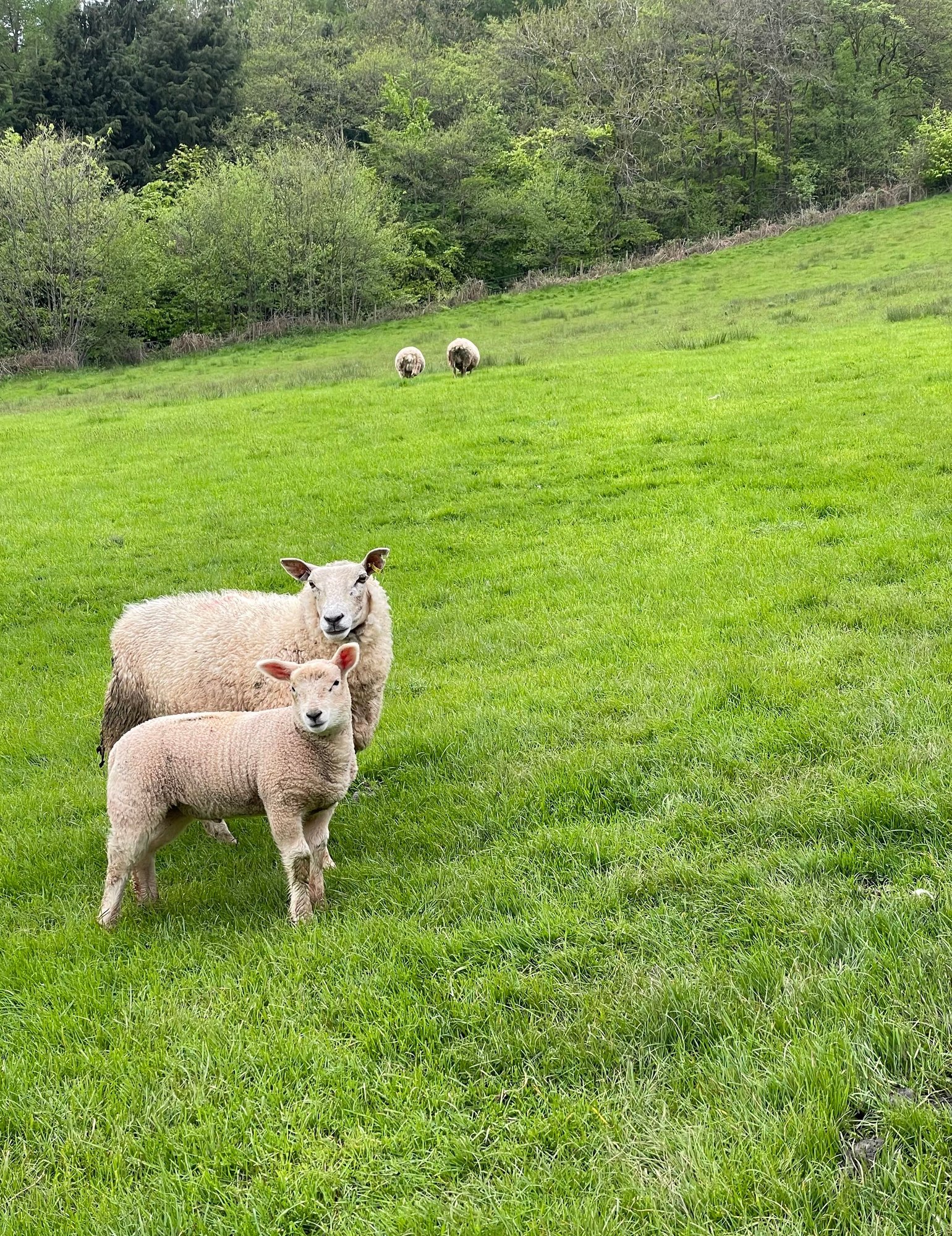
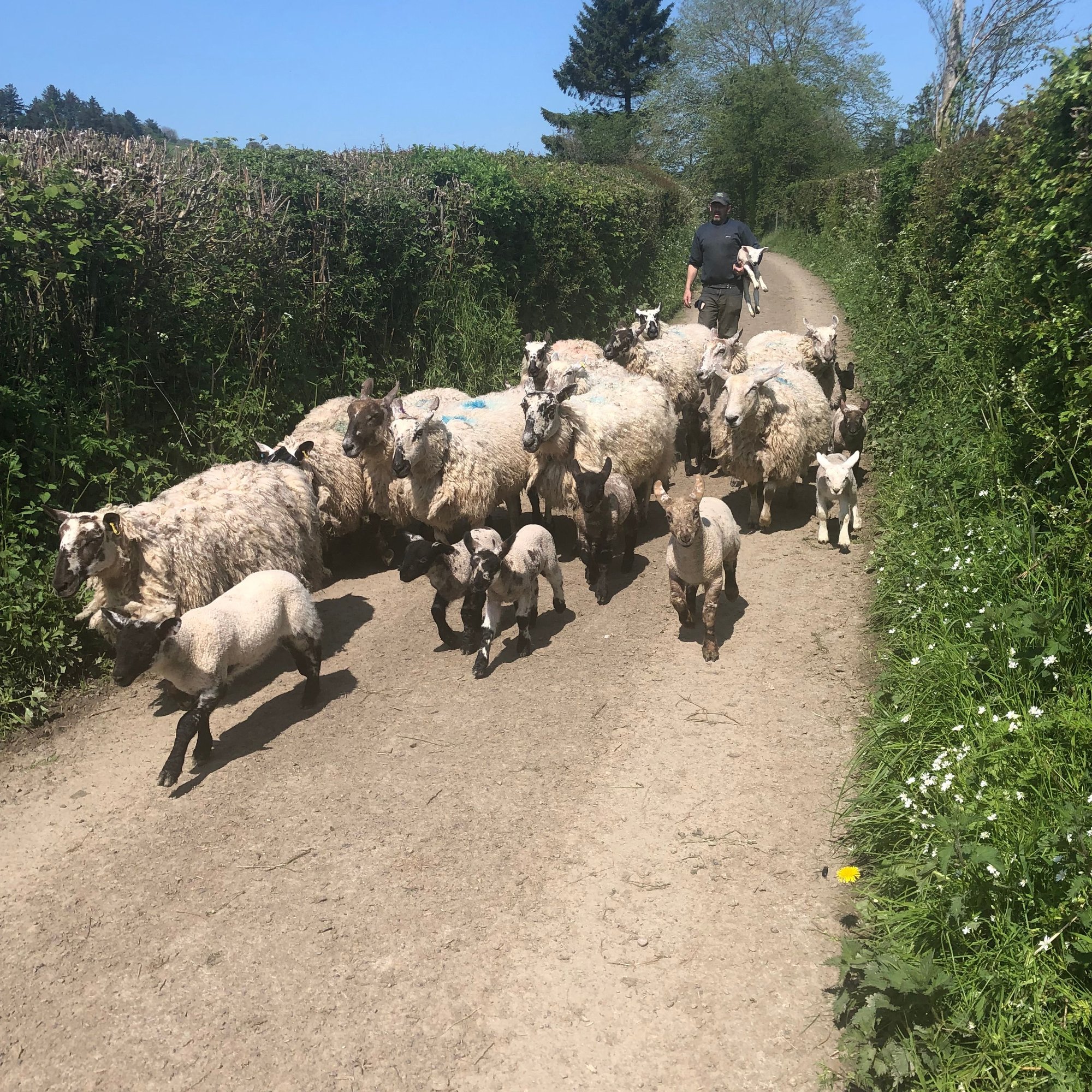
Later, we met a farmer driving his sheep to a field. He was carrying a lamb:
On we walked until we reached the village of Newchurch, where we had to climb Disgwylfa Hill. The sun was now full-on, but the climb was thankfully short. More rolling fields until Gladestry, which marks the foot of Hergest Ridge. It was at this point that I called our pre-booked taxi and set up a 4 pm meeting at the Swan in Kington. It made sense at that moment, given how fast we had been walking, but it turned out to be a miscalculation of the time it would take us to climb and descend the ridge.
We met more wild ponies on Hergest Ridge, including this pregnant mare:
The ascent was truly a breakheart hill if ever there was one; steep and shadeless, it rose through successive false summits before finally overlooking Kington. The descent, while easy, seemed endless, and neither of us wanted to keep our driver waiting. At our scheduled meeting time, we were still more than half a kilometre from the Swan. (Any hope of a quick half-pint while we waited for our taxi was now completely dashed.) I called our driver to tell him we�d need another 10 minutes, but he kindly offered to drive down a road towards us. Moments later we were hurtling down those narrow hedge-edged lanes in Wales, headed back to Hay-on-Wye.
A good second day, all-in-all, but neither of us were happy about having to hustle a bit to meet our taxi in Kington. We would have been wiser to have set a later pick-up.
Stats for the day: 25 km, 7 hours elapsed. (My app also said I burned 2,229 calories, which justified that evening�s pizza and beer.)
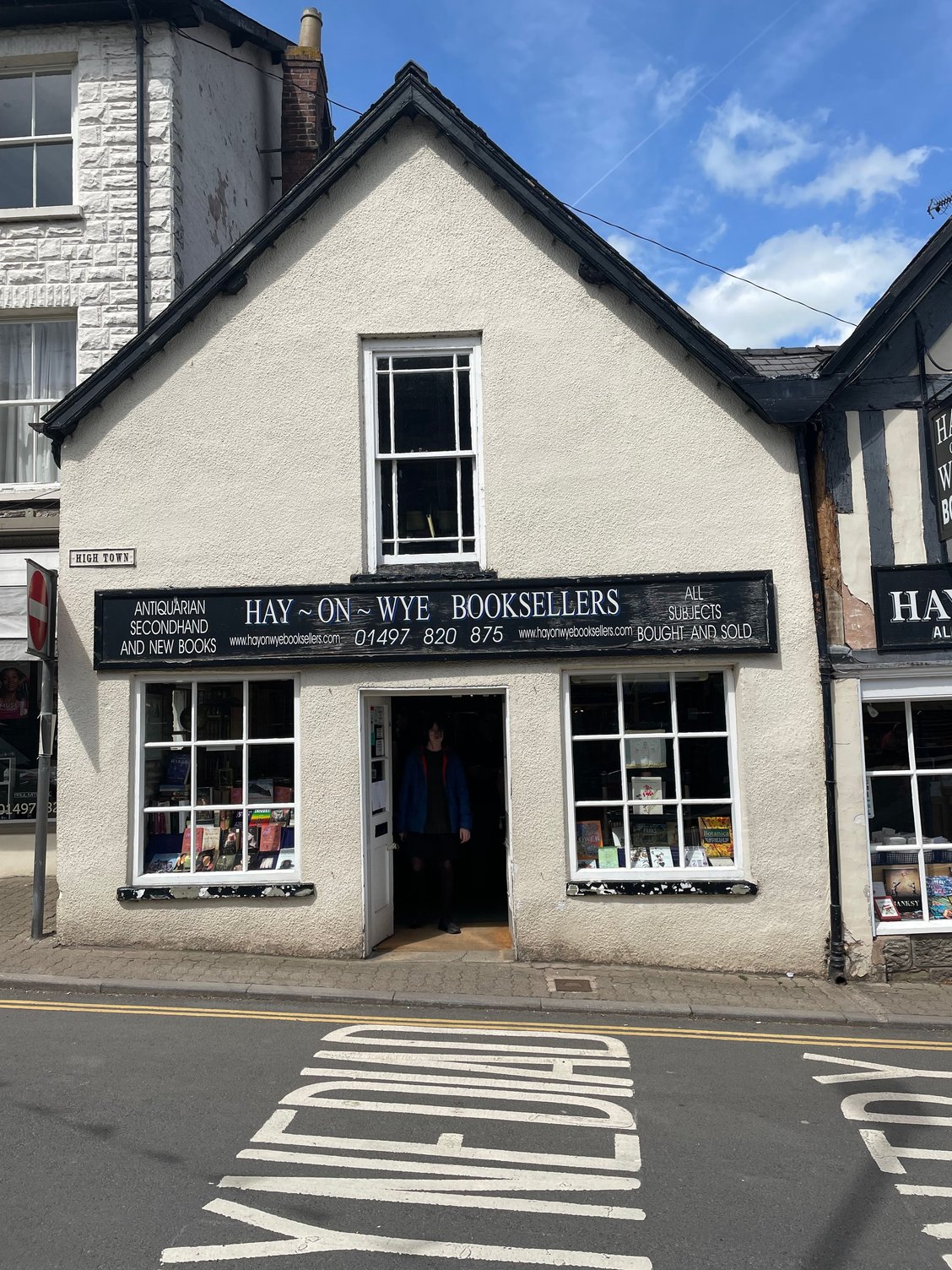
We then had a rest day in Hay-on-Wye. It is a charming village, well-known for its used bookshops.

Our second day was a walk from Hay to Kington, about 24 kilometres to the north. We set off around 9 am, walking at first under cloud, but then in heat and sunshine. We were soon in short-sleeved tees and wishing we had worn our shorts. We started with a pleasant walk by the Hay River, and we were soon back among hundreds of sheep. Fences and dry-stone walls ran beside us or across in front of us; regular gates, kissing gates, and stiles led from one field to another. We occasionally followed streams, and in these places we often encountered deep, slippery mud.
Mid-morning we met a bullock. The risk of injury by cattle had been on the mind of my wife Jeane, who had spent her early childhood on a farm. �Of all the ways I could possibly die, the last thing I want is to die by cow!� I know, it sounds like a remote possibility, but it does happen. (According to this report in the BBC, those who work with cattle are at the greatest risk, but it also happens to walkers, especially if they are accompanied by a dog. We, happily, were dogless. https://www.bbc.co.uk/news/uk-englan...shire-54268160 ) This particular bullock was alone in the field, but near our next gate. He started to walk away as we approached, but then he turned, lowered his head, and made a feint towards me. Happily, he immediately lost interest, and turned away again. We scooted through the gate.
Later, we met a farmer driving his sheep to a field. He was carrying a lamb:
On we walked until we reached the village of Newchurch, where we had to climb Disgwylfa Hill. The sun was now full-on, but the climb was thankfully short. More rolling fields until Gladestry, which marks the foot of Hergest Ridge. It was at this point that I called our pre-booked taxi and set up a 4 pm meeting at the Swan in Kington. It made sense at that moment, given how fast we had been walking, but it turned out to be a miscalculation of the time it would take us to climb and descend the ridge.
We met more wild ponies on Hergest Ridge, including this pregnant mare:
The ascent was truly a breakheart hill if ever there was one; steep and shadeless, it rose through successive false summits before finally overlooking Kington. The descent, while easy, seemed endless, and neither of us wanted to keep our driver waiting. At our scheduled meeting time, we were still more than half a kilometre from the Swan. (Any hope of a quick half-pint while we waited for our taxi was now completely dashed.) I called our driver to tell him we�d need another 10 minutes, but he kindly offered to drive down a road towards us. Moments later we were hurtling down those narrow hedge-edged lanes in Wales, headed back to Hay-on-Wye.
A good second day, all-in-all, but neither of us were happy about having to hustle a bit to meet our taxi in Kington. We would have been wiser to have set a later pick-up.
Stats for the day: 25 km, 7 hours elapsed. (My app also said I burned 2,229 calories, which justified that evening�s pizza and beer.)
We then had a rest day in Hay-on-Wye. It is a charming village, well-known for its used bookshops.
Jun 8th, 2023, 03:00 AM
#11
Original Poster
Join Date: Jul 2004
Posts: 4,470
Likes: 0
Received 0 Likes
on
0 Posts
The day after that, we made our transfer to Ulverston in Cumbria. On our first leg, our scheduled train was running two hours late, but the ticket agent said that we could get the one coming before ours, as it, too, was late. We boarded, but halfway along we were informed that our train was terminating two stops short of Manchester, our transfer point. The reason? �� because we are running late.� We had to scramble to come up with an alternate routing, jumping off at Crewe and catching a train to Preston. We were there able to catch a third train that got us in to Ulverston in time for our check-in at our B&B. Transport for Wales was the cause of all this; the man in the seat behind us referred to it as �Transport for Fails.�
Our accommodation in Ulverston: one night at Church Walk House, a lovely B&B with a genial, helpful host.
The Cumbria Way
Our next adventure was to walk the Cumbria Way, a 114 kilometre path from Ulverston on Morecambe Bay in the south to Carlisle in the north. This walk is described as the low-level or valley path through the Lake District. If you are a fell walker, used to walking along ridges and mountain tops, I suppose this is an accurate description, but it is still rated as �moderate to challenging.� I think this is largely due to the presence of rough terrain and repeated ascents and descents. (We often exceeded 500 metres a day of cumulative climb.) And while the trail begins and ends at nearly sea level, it does peak at 658 metres on High Pike in the Northern Fells. So yes, it is mostly low level, but it is still a workout.
We used Mickledore Travel for this part of our holiday, relying on them for booking all accommodation, packed lunches, luggage transfers, and taxi transfers where needed. Like Celtic Trails, they were responsive, thorough, and effective, and we have no reservations about recommending them. https://www.mickledore.co.uk/walking...-days-walking/
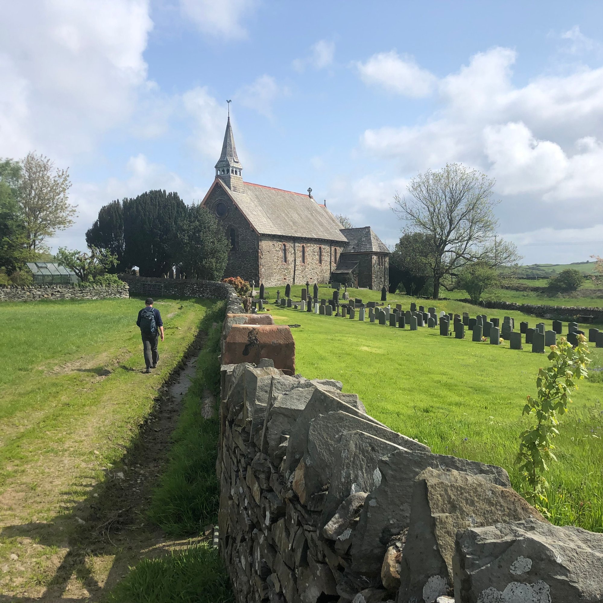
Our B&B in Ulverston was the one place that couldn�t provide packed lunches, so on our first morning we stopped by a bakery to pick up sandwiches before setting off for Coniston. We passed through hours of farmland, climbing one stile after another. Part way through the morning we were overtaken by three women running the same route. �Are you the Canadians?� they asked. We enquired how they knew, and they said that the staff at the bakery had told them that we were ahead of them. But not for long; they wished us well, ran quickly across the next field, and disappeared. Their plan was to run the entire Cumbria Way. Jeane and I are runners; these women left us in awe.
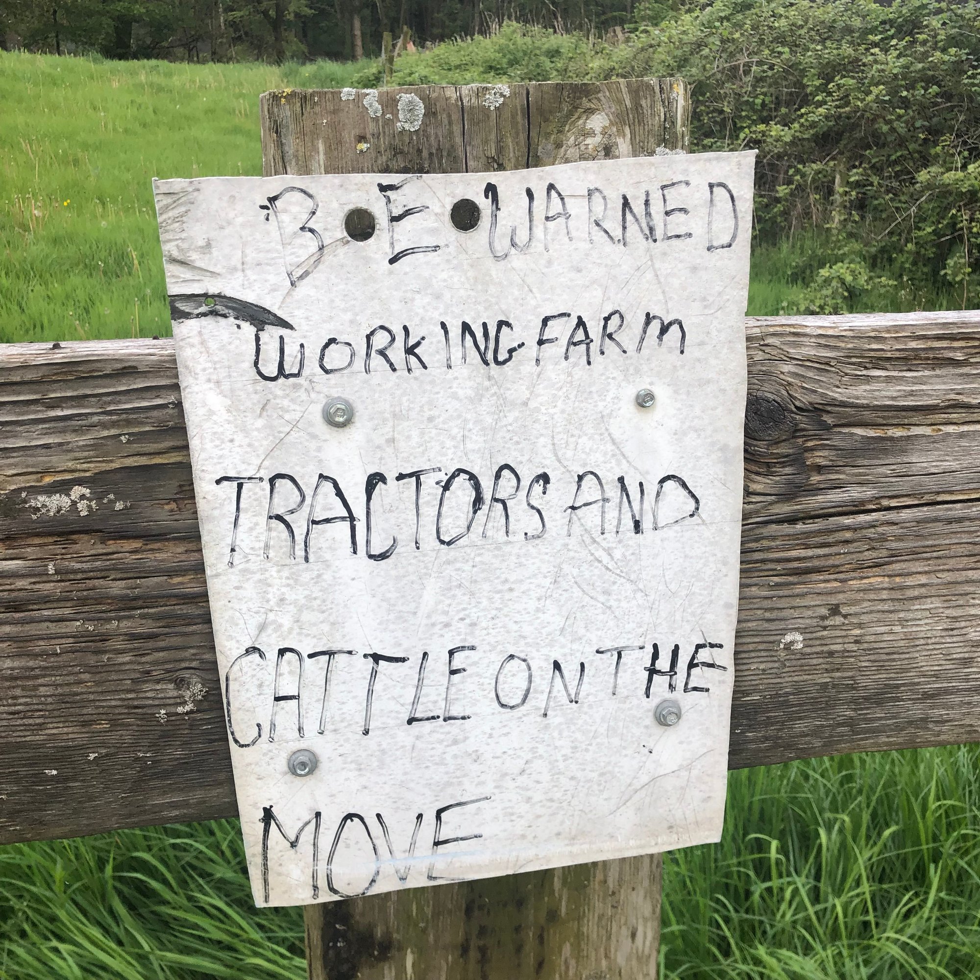
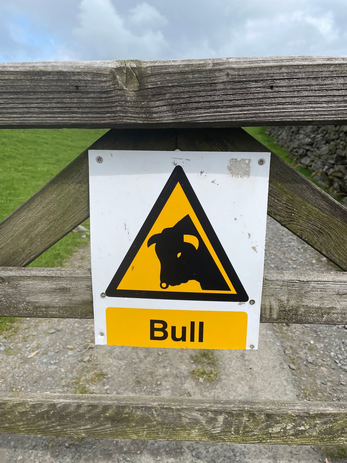
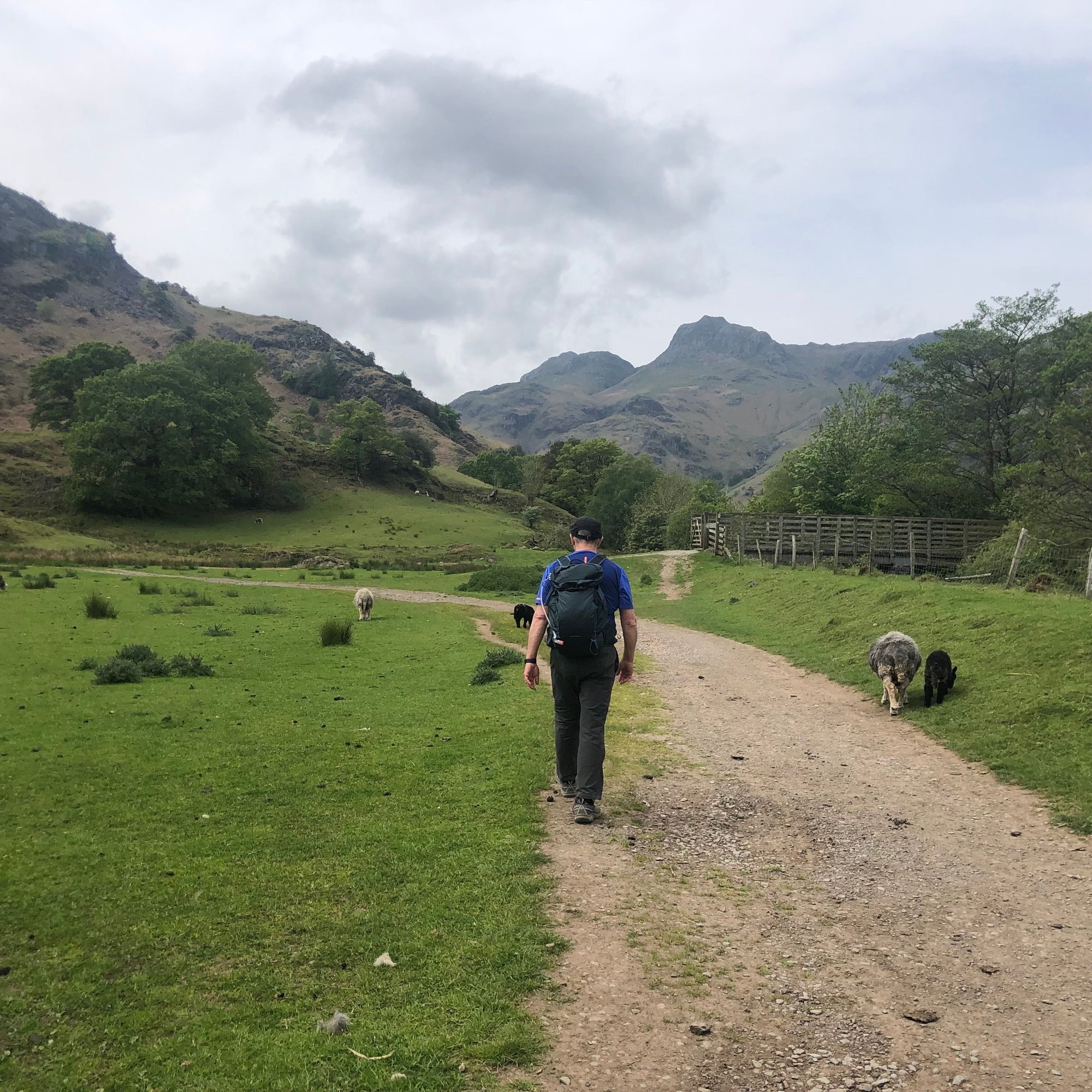
A while after that we encountered a gate with a sign warning us of a bull in the field. Oh, great news. But we saw only sheep, making me wonder whether the sign was a �just in case I want to put him there,� or simply a wind up. I completely understand how some farmers dislike having a public path running through their land (and sometimes even between their house and their barn). Someone leaving a gate ajar or letting their dog off leash near livestock, or trampling newly-sown fields would make any farmer bloody-minded.
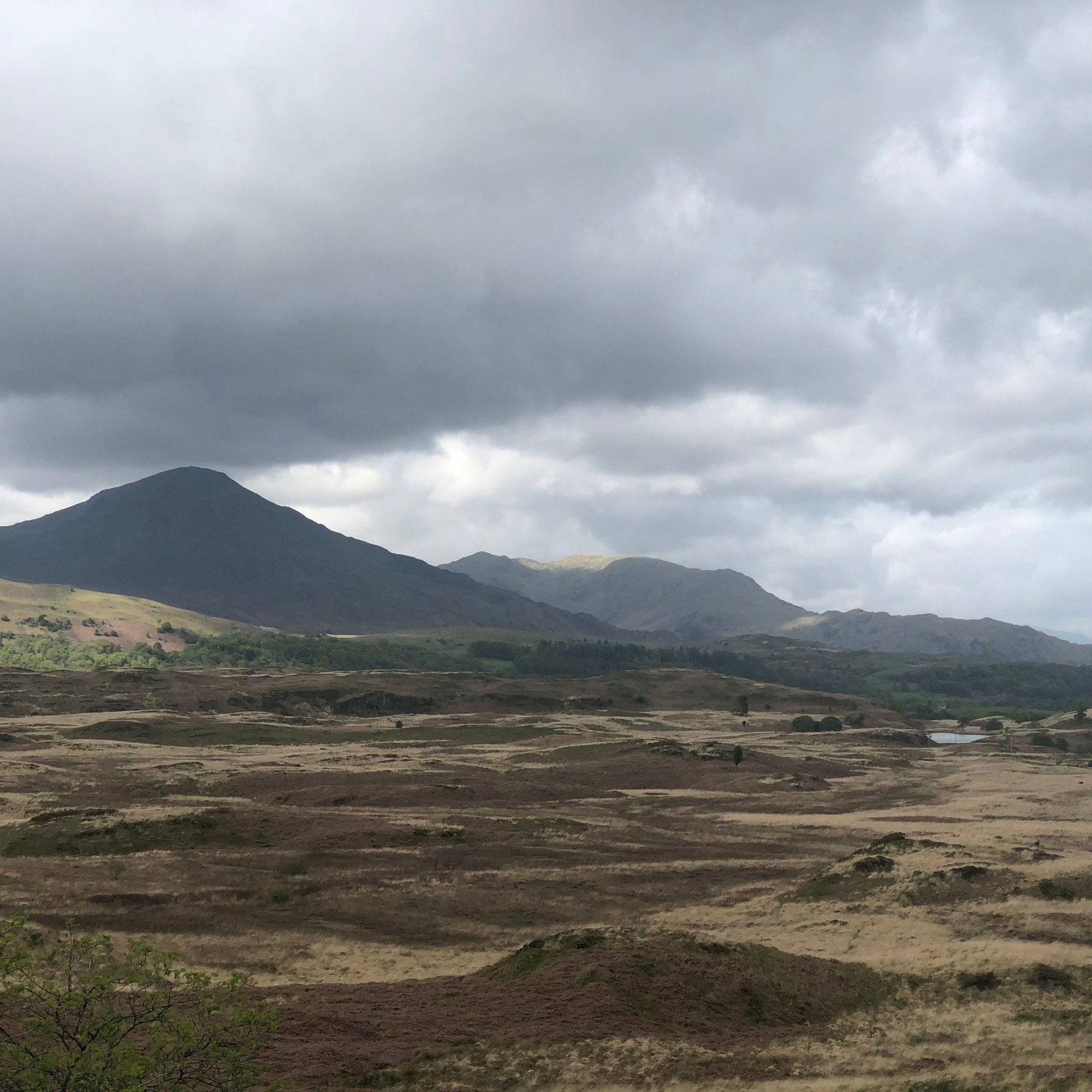
Somewhere around Gawthwaite we entered the Lake District National Park and we could soon see the Old Man of Coniston and the Coniston Fells in the distance. We reached Beacon Tarn (very wet and muddy around the edges) and then started a long and awkward descent to Coniston Water. Uneven ground and some challenging way-finding followed, but we ultimately found ourselves on the lakeshore, where we turned north to follow the water to Coniston. For future walkers on this route: this is a tranquil end to the day, but the path along the lake is uneven and root-filled; tripping is a real hazard when you�re tired.

Coniston Old Man and the Coniston Fells:
Stats for the day: this was our our longest day at 26.25 km and 9 hours of elapsed time.
Our accommodation in Coniston: two nights at the Yewdale Inn, which gave us a rest day after the long stage up from Ulverston. The Yewdale Inn has a lively bar and dining room, and helpful staff who organized an early breakfast for us on the morning we left.
Our accommodation in Ulverston: one night at Church Walk House, a lovely B&B with a genial, helpful host.
The Cumbria Way
Our next adventure was to walk the Cumbria Way, a 114 kilometre path from Ulverston on Morecambe Bay in the south to Carlisle in the north. This walk is described as the low-level or valley path through the Lake District. If you are a fell walker, used to walking along ridges and mountain tops, I suppose this is an accurate description, but it is still rated as �moderate to challenging.� I think this is largely due to the presence of rough terrain and repeated ascents and descents. (We often exceeded 500 metres a day of cumulative climb.) And while the trail begins and ends at nearly sea level, it does peak at 658 metres on High Pike in the Northern Fells. So yes, it is mostly low level, but it is still a workout.
We used Mickledore Travel for this part of our holiday, relying on them for booking all accommodation, packed lunches, luggage transfers, and taxi transfers where needed. Like Celtic Trails, they were responsive, thorough, and effective, and we have no reservations about recommending them. https://www.mickledore.co.uk/walking...-days-walking/
Our B&B in Ulverston was the one place that couldn�t provide packed lunches, so on our first morning we stopped by a bakery to pick up sandwiches before setting off for Coniston. We passed through hours of farmland, climbing one stile after another. Part way through the morning we were overtaken by three women running the same route. �Are you the Canadians?� they asked. We enquired how they knew, and they said that the staff at the bakery had told them that we were ahead of them. But not for long; they wished us well, ran quickly across the next field, and disappeared. Their plan was to run the entire Cumbria Way. Jeane and I are runners; these women left us in awe.
A while after that we encountered a gate with a sign warning us of a bull in the field. Oh, great news. But we saw only sheep, making me wonder whether the sign was a �just in case I want to put him there,� or simply a wind up. I completely understand how some farmers dislike having a public path running through their land (and sometimes even between their house and their barn). Someone leaving a gate ajar or letting their dog off leash near livestock, or trampling newly-sown fields would make any farmer bloody-minded.
Somewhere around Gawthwaite we entered the Lake District National Park and we could soon see the Old Man of Coniston and the Coniston Fells in the distance. We reached Beacon Tarn (very wet and muddy around the edges) and then started a long and awkward descent to Coniston Water. Uneven ground and some challenging way-finding followed, but we ultimately found ourselves on the lakeshore, where we turned north to follow the water to Coniston. For future walkers on this route: this is a tranquil end to the day, but the path along the lake is uneven and root-filled; tripping is a real hazard when you�re tired.
Coniston Old Man and the Coniston Fells:
Stats for the day: this was our our longest day at 26.25 km and 9 hours of elapsed time.
Our accommodation in Coniston: two nights at the Yewdale Inn, which gave us a rest day after the long stage up from Ulverston. The Yewdale Inn has a lively bar and dining room, and helpful staff who organized an early breakfast for us on the morning we left.
Jun 8th, 2023, 09:42 AM
#14
Original Poster
Join Date: Jul 2004
Posts: 4,470
Likes: 0
Received 0 Likes
on
0 Posts
Thank you all for the comments. (Just as an aside, I think one of the greatest things Fodor's ever did was to allow us to upload photos.)
mama_mia, Congrats on the Camino, and I agree, walking is truly a great way to see a country.
TDudette, thanks for that. We are just trying to keep old age at bay!
About the wild ponies on the ridges in Wales: I assume they see walkers every day, although perhaps less so in the winter, but they seemed to be completely unconcerned with our presence among them.
Next up: how we navigated our way, and then Conistion to Old Dungeon Ghyll.
mama_mia, Congrats on the Camino, and I agree, walking is truly a great way to see a country.
TDudette, thanks for that.
We are just trying to keep old age at bay!About the wild ponies on the ridges in Wales: I assume they see walkers every day, although perhaps less so in the winter, but they seemed to be completely unconcerned with our presence among them.
Next up: how we navigated our way, and then Conistion to Old Dungeon Ghyll.
Jun 8th, 2023, 10:11 AM
#15
Original Poster
Join Date: Jul 2004
Posts: 4,470
Likes: 0
Received 0 Likes
on
0 Posts
We Were�t Duffers
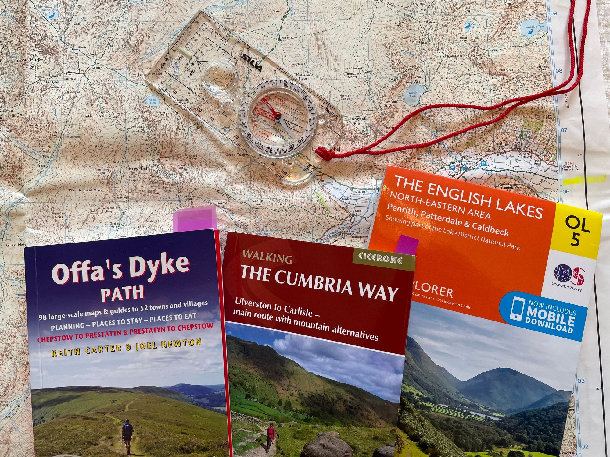
Did you ever read Arthur Ransome�s Swallows and Amazons, the first book about the adventures of children in the Lake District? If you did, you will recollect that the children�s mother had written their father, a naval officer who was in Malta, asking his views about their using a dinghy on the lake. He sent back a telegram: �Better drowned than duffers, if not duffers, won�t drown.� And so I felt about way-finding, another of our pre-trip anxieties. Better lost than duffers, I thought, so I revisited my navigation skills, once used in coastal sailing here in Nova Scotia. I acquired the appropriate UK Ordnance Survey Explorer maps (they have a 1:25,000 scale and show great details, including field boundaries and public pathways), pored over our routes, and refreshed my compass skills, should we need them. Once I was familiar with the OS symbols and the UK grid reference system, I felt we were almost ready.
Celtic Walks and Mickledore sent us route guidebooks and maps, but still a bit edgy, we bought a subscription to the online version of the entire UK OS mapping. This is a fantastic app that allows you to call up any spot in the UK at a scale of 1:25,000, so you essentially have the entire Explorer series on your phone. You can also download any area you choose so that it can be used offline when you are out of cellular coverage. (There were significant portions of both trails where we had no cellular signal.) The most brilliant feature of the app is the small red arrow that pinpoints your exact location. While I carried the appropriate paper maps on the trail, our usual methodology was for Jeane to read out the directions from the guidebook while I called up the OS app when we wanted to be sure we were in the right place or on the right path. We did miss the odd turn, but we usually caught it straight away. We didn�t get lost.
This leads me to say that both Offa�s Dyke Path and the Cumbria Way are marked, but inconsistently. Many of the marks confirm that you have found the right ford, the right fork, or the right gate, but they fail as an explicit indication of where to go next. This is complicated by the multitude of diverging and crisscrossing paths all along the way. I cannot imagine doing it without a guide book and the 1:25,000 paper maps. Adding the OS Online app puts the icing on the cake.
There is a risk of using an electronic device. As I mentioned, we always had our paper maps with us, but we had also downloaded the offline maps to Jeane�s iPhone, as backup to mine. Jeane�s phone had an external battery pack and I carried a power bank. We had backup to our backup to our backup, you might say. And just in case we had an accident while out of cellular coverage, we had my daughter�s Garmin InReach, which has satellite texting in case of an emergency.
Coniston to Great Langdale
On our second day of hiking in the Lake District, we walked from Coniston to the old Dungeon Ghyll Hotel in Great Langdale. This stage climbed out of Coniston, ever upwards towards the scenic and popular Tarn Hows. Two kilometres in, I realized that something was wrong with my left boot. I have walked for years in Keen�s Targhees. This was my third pair, barely four months old and with less than 300 kilometres under foot. Crazily, the tread had delaminated and was now flapping around; the only way to walk was to cut the tread away, completely exposing the smooth sole of the boot. We considered walking back to Coniston, a small town with a single outfitter, but the likelihood of their having my size (a short but very wide foot) was remote. So we pressed on, realizing that the earliest I would then be able to find new boots would be in Keswick, a couple of days ahead.

Our last view of Coniston Water:
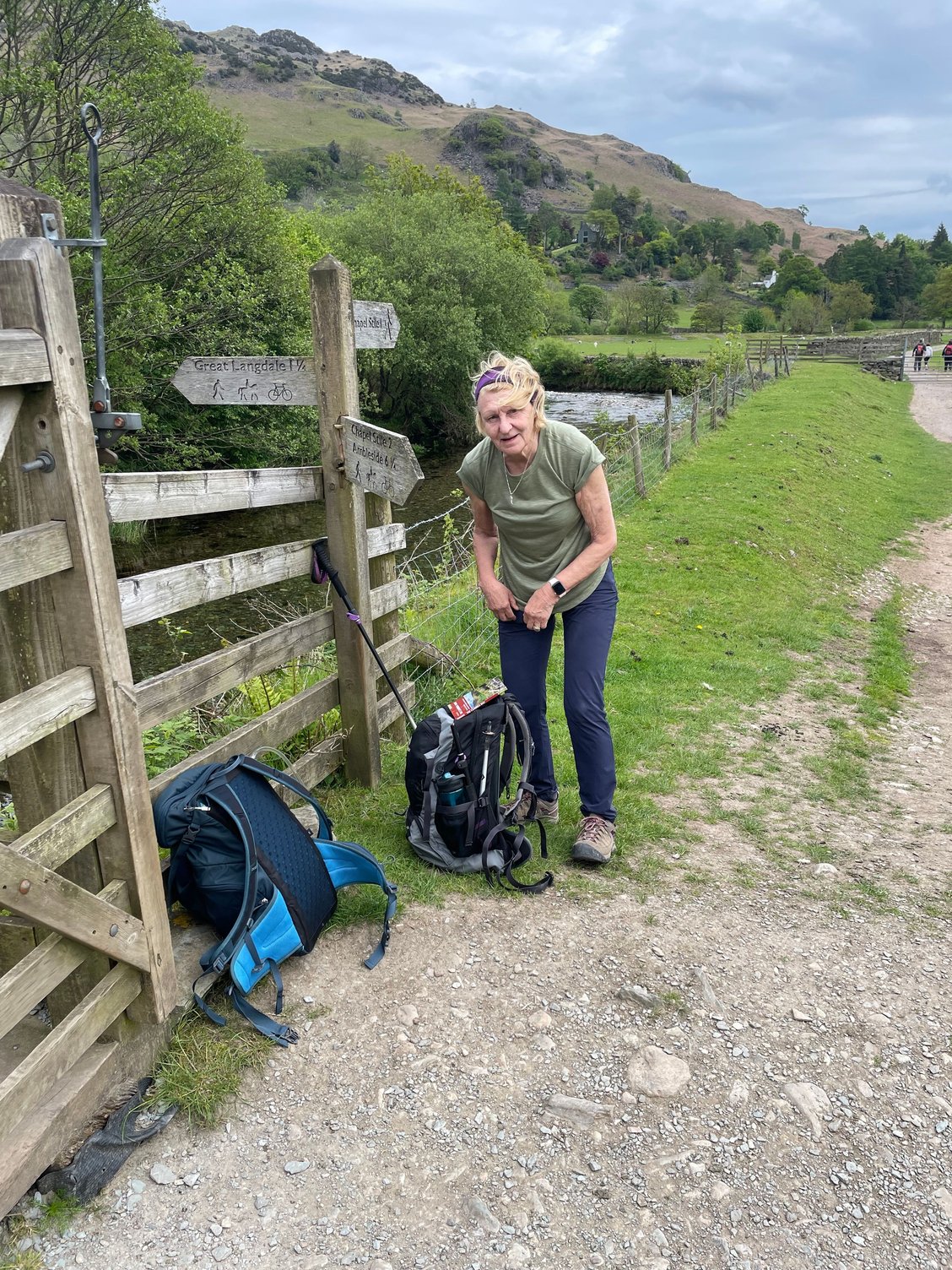
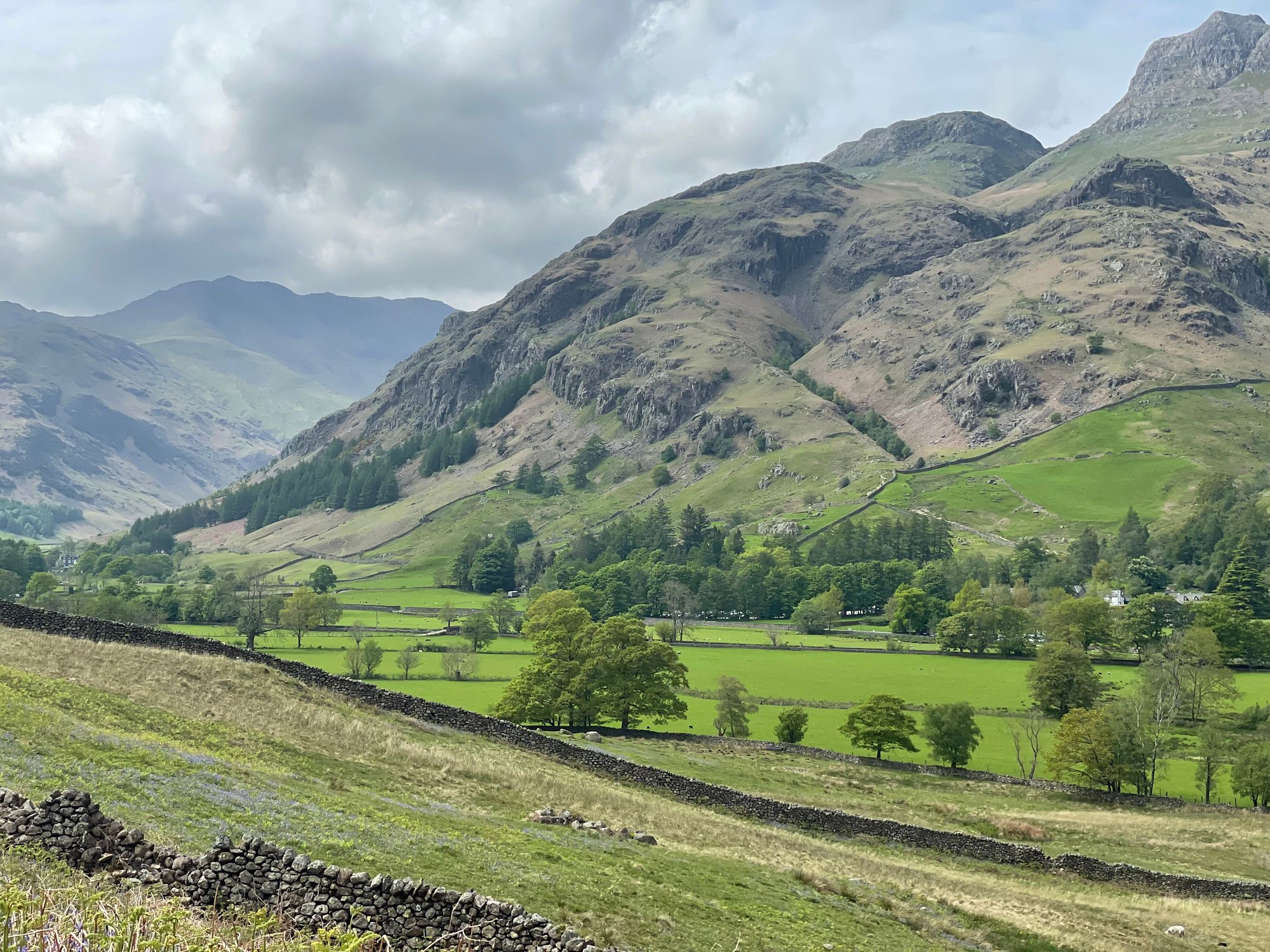
The path followed more fields and woods, initially under the shadow of the Yewdale Fells. We climbed up to Tarn Hows, where we ran into a lot of people out for the day, and then made a gradual descent to the River Brathy. We then entered a park-like setting bordering Elter Water, another place filled with day-walkers. This led us to the opening of the valley known as Great Langdale, where we followed a brook, past Chapel Stile, and finally to our accommodation.
The valley of Great Langdale opening up before us:
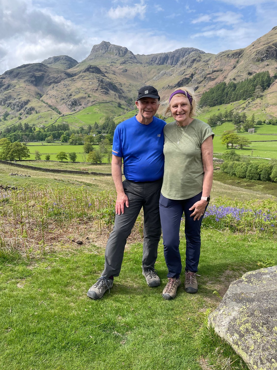
Time for a water break:
Stats for the day: 18.5 km, 6.5 hours elapsed time
Accommodation: one night at the Old Dungeon Ghyll. A classic walker�s inn, situated under the towering slopes of Great Langdale. Drinks and dinner in the Hikers� Bar.
Did you ever read Arthur Ransome�s Swallows and Amazons, the first book about the adventures of children in the Lake District? If you did, you will recollect that the children�s mother had written their father, a naval officer who was in Malta, asking his views about their using a dinghy on the lake. He sent back a telegram: �Better drowned than duffers, if not duffers, won�t drown.� And so I felt about way-finding, another of our pre-trip anxieties. Better lost than duffers, I thought, so I revisited my navigation skills, once used in coastal sailing here in Nova Scotia. I acquired the appropriate UK Ordnance Survey Explorer maps (they have a 1:25,000 scale and show great details, including field boundaries and public pathways), pored over our routes, and refreshed my compass skills, should we need them. Once I was familiar with the OS symbols and the UK grid reference system, I felt we were almost ready.
Celtic Walks and Mickledore sent us route guidebooks and maps, but still a bit edgy, we bought a subscription to the online version of the entire UK OS mapping. This is a fantastic app that allows you to call up any spot in the UK at a scale of 1:25,000, so you essentially have the entire Explorer series on your phone. You can also download any area you choose so that it can be used offline when you are out of cellular coverage. (There were significant portions of both trails where we had no cellular signal.) The most brilliant feature of the app is the small red arrow that pinpoints your exact location. While I carried the appropriate paper maps on the trail, our usual methodology was for Jeane to read out the directions from the guidebook while I called up the OS app when we wanted to be sure we were in the right place or on the right path. We did miss the odd turn, but we usually caught it straight away. We didn�t get lost.
This leads me to say that both Offa�s Dyke Path and the Cumbria Way are marked, but inconsistently. Many of the marks confirm that you have found the right ford, the right fork, or the right gate, but they fail as an explicit indication of where to go next. This is complicated by the multitude of diverging and crisscrossing paths all along the way. I cannot imagine doing it without a guide book and the 1:25,000 paper maps. Adding the OS Online app puts the icing on the cake.
There is a risk of using an electronic device. As I mentioned, we always had our paper maps with us, but we had also downloaded the offline maps to Jeane�s iPhone, as backup to mine. Jeane�s phone had an external battery pack and I carried a power bank. We had backup to our backup to our backup, you might say. And just in case we had an accident while out of cellular coverage, we had my daughter�s Garmin InReach, which has satellite texting in case of an emergency.
Coniston to Great Langdale
On our second day of hiking in the Lake District, we walked from Coniston to the old Dungeon Ghyll Hotel in Great Langdale. This stage climbed out of Coniston, ever upwards towards the scenic and popular Tarn Hows. Two kilometres in, I realized that something was wrong with my left boot. I have walked for years in Keen�s Targhees. This was my third pair, barely four months old and with less than 300 kilometres under foot. Crazily, the tread had delaminated and was now flapping around; the only way to walk was to cut the tread away, completely exposing the smooth sole of the boot. We considered walking back to Coniston, a small town with a single outfitter, but the likelihood of their having my size (a short but very wide foot) was remote. So we pressed on, realizing that the earliest I would then be able to find new boots would be in Keswick, a couple of days ahead.
Our last view of Coniston Water:
The path followed more fields and woods, initially under the shadow of the Yewdale Fells. We climbed up to Tarn Hows, where we ran into a lot of people out for the day, and then made a gradual descent to the River Brathy. We then entered a park-like setting bordering Elter Water, another place filled with day-walkers. This led us to the opening of the valley known as Great Langdale, where we followed a brook, past Chapel Stile, and finally to our accommodation.
The valley of Great Langdale opening up before us:
Time for a water break:
Stats for the day: 18.5 km, 6.5 hours elapsed time
Accommodation: one night at the Old Dungeon Ghyll. A classic walker�s inn, situated under the towering slopes of Great Langdale. Drinks and dinner in the Hikers� Bar.
Jun 8th, 2023, 05:30 PM
#17
Original Poster
Join Date: Jul 2004
Posts: 4,470
Likes: 0
Received 0 Likes
on
0 Posts
Jun 9th, 2023, 02:20 AM
#20
Original Poster
Join Date: Jul 2004
Posts: 4,470
Likes: 0
Received 0 Likes
on
0 Posts
We �Wandered Lonely as a Cloud�
William Wordsworth lived much of his life in the Lake District. While his wandering was the prelude to discovering golden daffodils, it aptly describes our journey from the Old Dungeon Ghyll to the village of Rosthwaite in Borrowdale.
Our path took us from Great Langdale into Mickleden, a blind valley with tall overhanging crags.
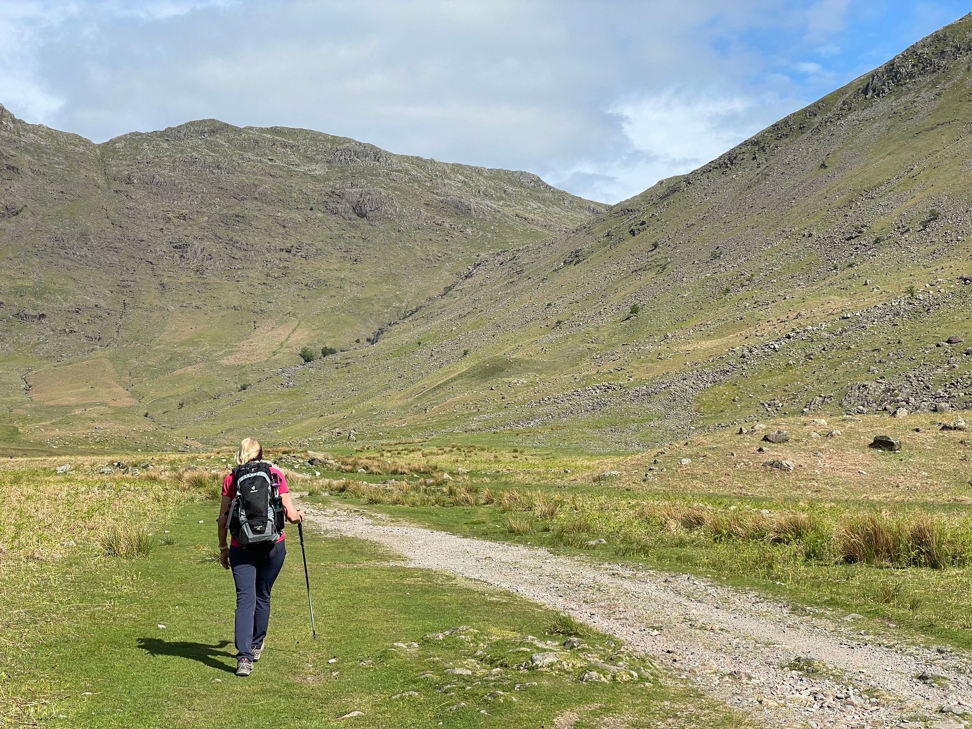
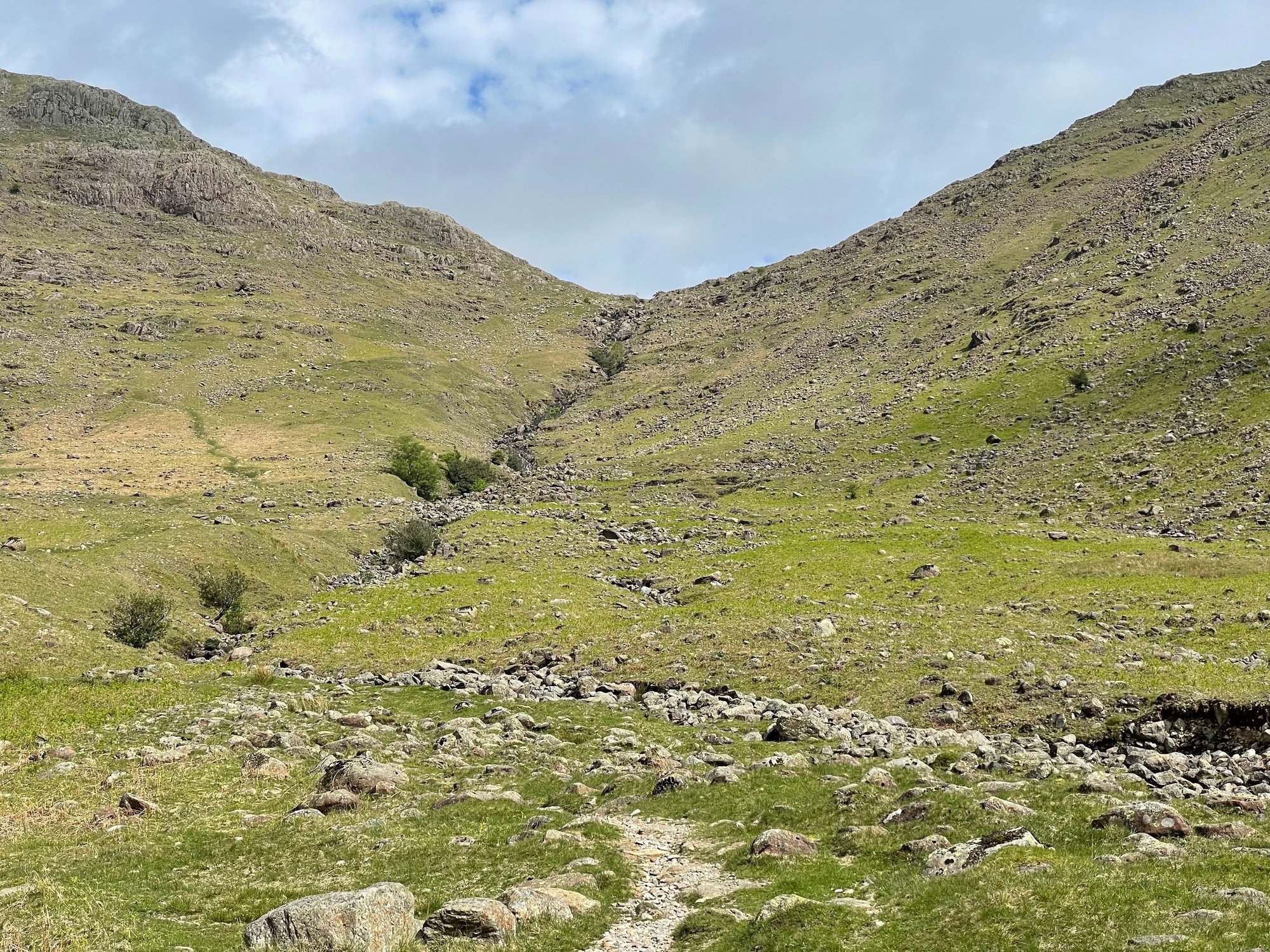
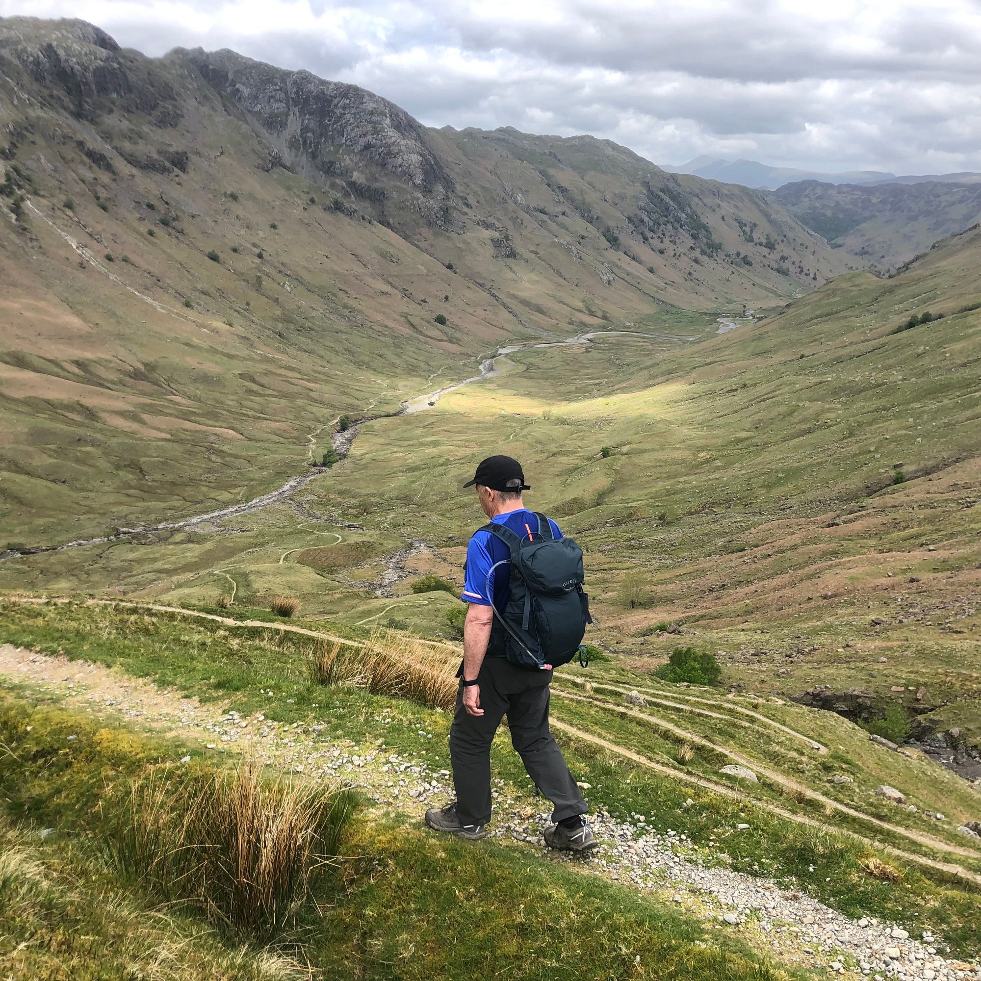
Mickleden ended in a wall of rock. From a distance, it looked like a puzzle, but the Cumbria Way followed a steep trail of switchbacks that led up to a col. As the slope eased, we passed a cairn marking the summit. This was Stake Pass, and as challenging as it was to climb up, the descent was a vertiginous drop with what must have had fifty switchbacks. We eased our way down, having first paused to admire the extraordinary sight Langstrath, an uninhabited valley stretching beneath us, running north as far as the eye could see.
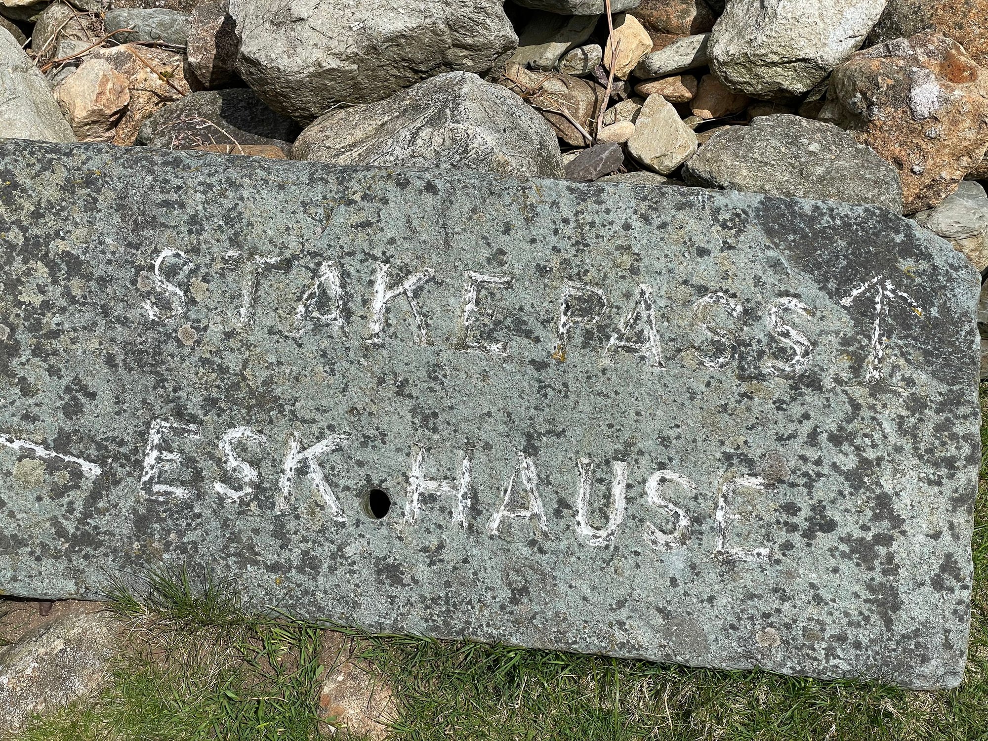
The route up to Stake Pass:
The view back into Mickleden from the summit of Stake Pass. The Old Dungeon Ghyll, where we started the day, is around the left corner at the far end of the valley:

The uninhabited Langstrath, with all of the switchbacks leading down to the valley floor. You can just make out the silhouette of Skiddaw fell in the distance:
We would have loved a smooth track on the valley floor, but we faced rocks, boulders, marshy bits, and constant undulations. �The going is a little intricate across bouldery ground,� said the guidebook. A classic understatement. It was unrelenting, all the way to the left turn into Borrowdale. There it finally eased, and we were soon walking beside the Stonethwaite Beck, which we followed to Rosthwaite.
Lonely it was; we saw no more than a couple of other walkers the entire day.
Having learned our lesson in Wales about setting a specific time to meet our taxi transfer, we waited until we arrived In Rosthwaite before we called our pre-booked taxi. Thirty minutes later we we being driven to Keswick. (Our trail organizer had initially tried to book us a B&B in Rosthwaite, but there were no vacancies, so they arranged the taxi onwards to Keswick and then back out to Rosthwaite the next morning.)
Stats for the day: 14 km, about 5.75 hours elapsed
Our accommodation in Keswick: three nights at Hillcrest22, the best B&B on our entire trip. It is an old building, completely refurbished, overlooking Derwentwater and Borrowdale. The staff were warm and helpful, and the breakfasts and packed lunches were delicious.
We arrived in time for me to shop for new boots. Our host suggested George Fisher. �They are not going to be the cheapest, but they are well-known for their fitting.� They had Keen Targhees, which I knew would fit perfectly, but I will not trust them again, so I got pair of Meindl�s. There was a risk walking long days in a new type of boot, but two days of walking without a proper tread had been enough. The new boots turned out to be just fine.
Rosthwaite to Keswick
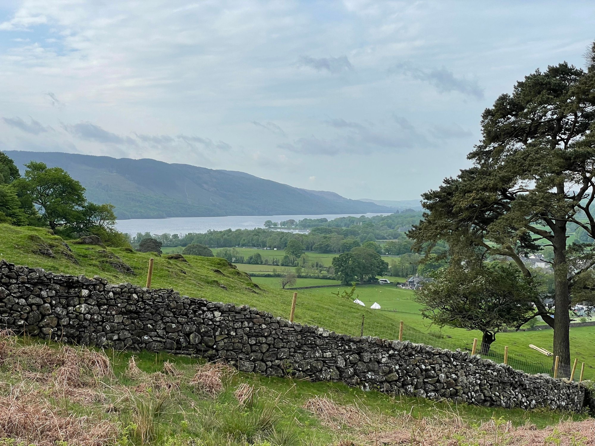
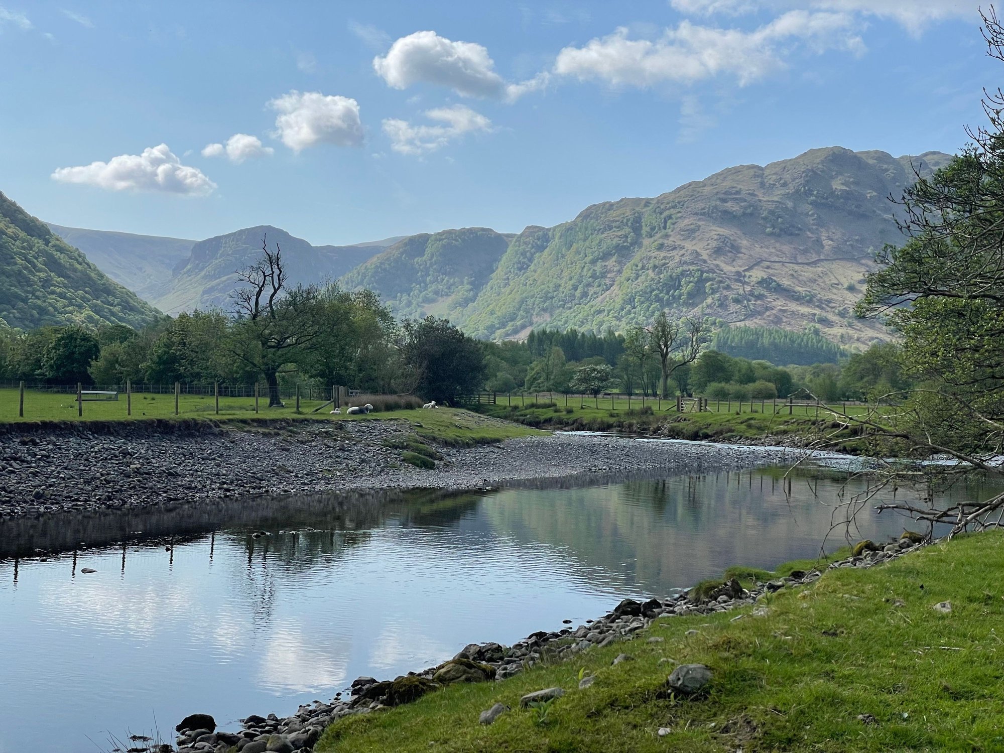
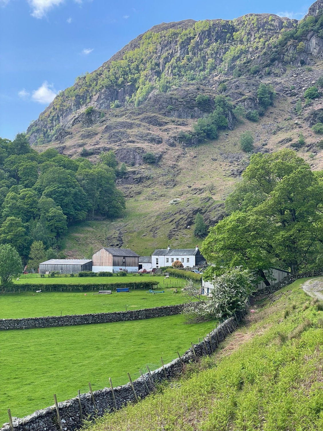
The next morning our taxi picked us up and drove us back out to Rosthwaite. This was a morning and early afternoon of easy walking through Borrowdale, starting first along the River Derwent and then passing through more woods, farmyards, and fields. We ultimately arrived at the southern end of Derwentwater, and we then followed the western shore all the way up to Keswick.
Stats for the day: 13.5 km, 4.5 hours elapsed
The River Derwent:
The valley of Borrowdale:
And finally Derwentwater;

William Wordsworth lived much of his life in the Lake District. While his wandering was the prelude to discovering golden daffodils, it aptly describes our journey from the Old Dungeon Ghyll to the village of Rosthwaite in Borrowdale.
Our path took us from Great Langdale into Mickleden, a blind valley with tall overhanging crags.
Mickleden ended in a wall of rock. From a distance, it looked like a puzzle, but the Cumbria Way followed a steep trail of switchbacks that led up to a col. As the slope eased, we passed a cairn marking the summit. This was Stake Pass, and as challenging as it was to climb up, the descent was a vertiginous drop with what must have had fifty switchbacks. We eased our way down, having first paused to admire the extraordinary sight Langstrath, an uninhabited valley stretching beneath us, running north as far as the eye could see.
The route up to Stake Pass:
The view back into Mickleden from the summit of Stake Pass. The Old Dungeon Ghyll, where we started the day, is around the left corner at the far end of the valley:
The uninhabited Langstrath, with all of the switchbacks leading down to the valley floor. You can just make out the silhouette of Skiddaw fell in the distance:
We would have loved a smooth track on the valley floor, but we faced rocks, boulders, marshy bits, and constant undulations. �The going is a little intricate across bouldery ground,� said the guidebook. A classic understatement. It was unrelenting, all the way to the left turn into Borrowdale. There it finally eased, and we were soon walking beside the Stonethwaite Beck, which we followed to Rosthwaite.
Lonely it was; we saw no more than a couple of other walkers the entire day.
Having learned our lesson in Wales about setting a specific time to meet our taxi transfer, we waited until we arrived In Rosthwaite before we called our pre-booked taxi. Thirty minutes later we we being driven to Keswick. (Our trail organizer had initially tried to book us a B&B in Rosthwaite, but there were no vacancies, so they arranged the taxi onwards to Keswick and then back out to Rosthwaite the next morning.)
Stats for the day: 14 km, about 5.75 hours elapsed
Our accommodation in Keswick: three nights at Hillcrest22, the best B&B on our entire trip. It is an old building, completely refurbished, overlooking Derwentwater and Borrowdale. The staff were warm and helpful, and the breakfasts and packed lunches were delicious.
We arrived in time for me to shop for new boots. Our host suggested George Fisher. �They are not going to be the cheapest, but they are well-known for their fitting.� They had Keen Targhees, which I knew would fit perfectly, but I will not trust them again, so I got pair of Meindl�s. There was a risk walking long days in a new type of boot, but two days of walking without a proper tread had been enough. The new boots turned out to be just fine.
Rosthwaite to Keswick
The next morning our taxi picked us up and drove us back out to Rosthwaite. This was a morning and early afternoon of easy walking through Borrowdale, starting first along the River Derwent and then passing through more woods, farmyards, and fields. We ultimately arrived at the southern end of Derwentwater, and we then followed the western shore all the way up to Keswick.
Stats for the day: 13.5 km, 4.5 hours elapsed
The River Derwent:
The valley of Borrowdale:
And finally Derwentwater;

